


Northrn England - AA Road Maps 7
Publisher: AA
Format: Paperback
ISBN: 0749515511
Northern England – AA Road Maps 7 (1997) – Automobile Association
AA Publishing | ISBN: 0749515511
Condition: Good | Sold by Crappy Old Books
Northern England. A magnificent expanse of dramatic landscapes, industrial cities, ancient market towns, windswept moorlands and people who have traditionally maintained that everything south of Sheffield is getting dangerously close to France. Here, the roads wind through spectacular countryside, the weather changes approximately every seventeen minutes, and the inhabitants possess an admirable ability to describe a torrential downpour as being a bit damp.
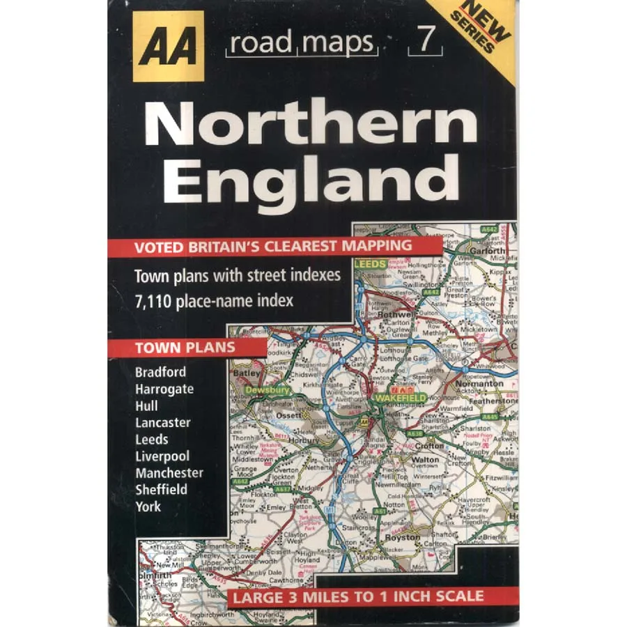
Welcome to Northern England – AA Road Maps 7, a splendid 1997 motoring map from the Automobile Association, published when navigating Britain’s highways still required a certain amount of geographical intelligence, rather than simply trusting a small electronic device to direct you through somebody’s back garden.
Part of the AA’s new road map series, this publication proudly announces that its cartography was voted Britain’s clearest mapping, a reassuring claim for anyone who has ever spent twenty minutes attempting to distinguish a minor road from a railway line while parked on the hard shoulder of the M62.
The map covers a substantial portion of northern England at a practical three-miles-to-one-inch scale, providing an excellent overview of the roads, towns and transport connections linking some of Britain’s most historically significant regions.
And there is plenty to explore.
From the industrial heritage of Manchester, Leeds, Sheffield and Bradford to the historic streets of York, the maritime traditions of Liverpool and Hull, and the charming surroundings of Harrogate and Lancaster, northern England offers a remarkable combination of urban history, rural beauty and places where the local inhabitants insist that their particular town produces the finest fish and chips in civilisation.
The publication includes town plans for nine major locations, including Bradford, Harrogate, Hull, Lancaster, Leeds, Liverpool, Manchester, Sheffield and York, along with street indexes and an impressive 7,110-place-name index.
Seven thousand one hundred and ten places. Enough to keep even the most enthusiastic touring motorist occupied for several lifetimes, particularly if they insist upon stopping at every village to investigate the pub.
Published in 1997, this map also captures the north of England at a fascinating moment of transition. Former industrial areas were undergoing regeneration, motorway networks were developing, and traditional manufacturing towns were adapting to an economy increasingly dominated by services, commerce and the mysterious business of turning old warehouses into expensive apartments.
For local historians and enthusiasts of vintage cartography, the appeal lies in comparing the road network and settlements of the late 1990s with the considerably altered landscape of today.
There is something wonderfully nostalgic about the map’s bold black-and-yellow cover, detailed road illustrations and confident promise of clear navigation. It belongs to an age when motorists carried paper maps in the glove compartment alongside emergency boiled sweets, a torch and a collection of petrol receipts they had absolutely no intention of examining.
This 1997 AA Road Maps 7 – Northern England, offered in Good condition by Crappy Old Books, is an appealing acquisition for collectors of vintage motoring literature, northern local historians and anyone nostalgic for the days when planning a journey involved unfolding an enormous map across the kitchen table.
A detailed geographical snapshot of northern England before the twenty-first century began rearranging its roads, towns and industrial landscapes.
And proof that getting from Manchester to York once involved considerably more than tapping
Keep browsing: See more Maps books Other books by AA
